
Severe Tropical Cyclone Alfred formed in late February 2025 and developed into a powerful Category 4 system that posed a significant threat to communities along Australia’s eastern seaboard. The storm’s unusual trajectory and subtropical transition made it a complex meteorological event requiring sustained monitoring by emergency services and residents throughout southeast Queensland and northeastern New South Wales.
This article provides a comprehensive account of Cyclone Alfred’s path, impacts, and the official response based on data from the Bureau of Meteorology and other authoritative sources. As of April 2026, the cyclone has fully dissipated, with all information reflecting post-event analyses rather than live tracking capabilities.
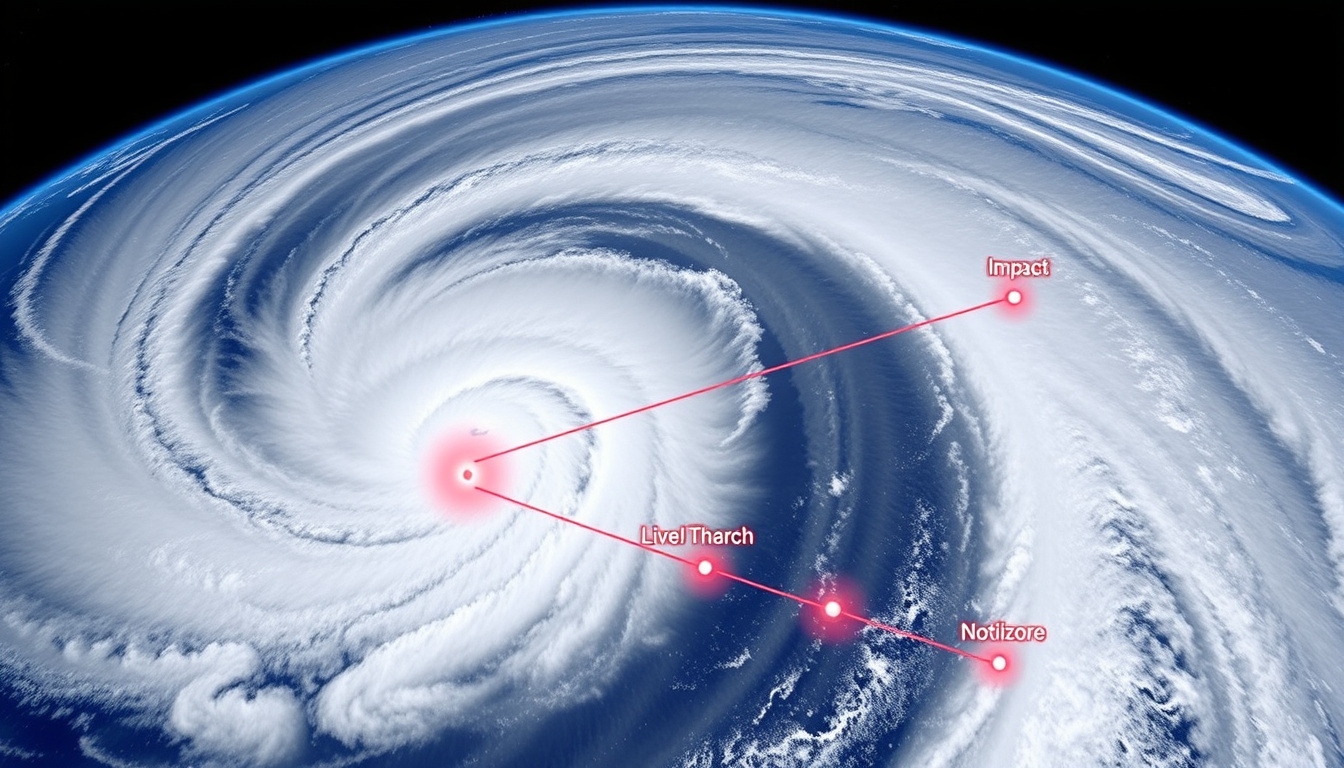
Cyclone Alfred at a Glance
Understanding Cyclone Alfred requires examining several key metrics that defined its behavior and potential for destruction throughout its lifecycle.
Fully dissipated as of 8 March 2025. Peak: Category 4 at 17.8°S 155.7°E on 27 February 2025.
Peak: 165 km/h sustained (90 knots), gusts to 215 km/h. Pressure data not specified in official records.
Erratic southeast Queensland approach after subtropical transition, ultimately weakening before significant landfall.
Emergency Warnings issued for Gold Coast and Redland City at highest level on 7 March 2025.
Key Insights
- Cyclone Alfred underwent an uncommon subtropical transition between 1-3 March, temporarily weakening before reorganising as a tropical system
- The storm’s erratic movement from 4-6 March, caused by weak steering currents, complicated forecasting efforts
- Approximately 120 Australian Defence Force personnel were deployed to northern New South Wales to support State Emergency Services operations
- Brisbane Airport radar disruptions affected airservices operations nationwide during the active phase
- Wind gusts reaching 120 km/h were recorded at Cape Byron on 7 March, with damaging gusts extending through the Gold Coast and Brisbane regions
- The system remained a notable event due to its longevity, intensity fluctuations, and unpredictable path characteristics
Snapshot Facts
| Attribute | Details |
|---|---|
| Name | Severe Tropical Cyclone Alfred (22U) |
| Peak Category | Category 4 |
| Peak Location | 17.8°S 155.7°E (approximately 1,000 km offshore) |
| Peak Wind Speed | 165 km/h sustained (90 knots), gusts to 215 km/h |
| Formation Date | 22 February 2025 |
| Dissipation Date | 8 March 2025 |
| Land Impact Regions | Southeast Queensland, Northeastern New South Wales |
Formation and Track Development
Cyclone Alfred originated as a tropical disturbance on 22 February 2025, approximately 400 kilometres northeast of Cairns near coordinates 15.4°S 149.7°E. The system quickly organised as it moved southeastward along the Queensland coast, reaching Category 1 status by 24 February and intensifying to Category 2 by 26 February.
Peak Intensity Phase
Between 27 and 28 February, Alfred reached its maximum intensity as a Category 4 system. Official tracking data from Weather Underground indicates the storm’s centre positioned at 17.8°S 155.7°E on 27 February, with sustained winds of 90 knots (165 km/h) and gusts reaching 215 km/h. By 28 February, the system had shifted slightly southward to 20.4°S 155.7°E while beginning to weaken, dropping to Category 3 status.
The Bureau of Meteorology records wind speeds using 10-minute sustained averages, which differ from the 1-minute averages used by some international agencies. This distinction affects direct comparisons with Atlantic hurricane classifications.
Subtropical Transition and Re-intensification
A significant development occurred on 1-3 March when Alfred passed over Cato Island and underwent a subtropical transition. During this phase, wind speeds decreased to 45-55 knots (85-100 km/h), characteristic of subtropical systems that derive energy from both warm waters and atmospheric temperature gradients rather than purely from sea surface temperatures alone.
This transition proved temporary. By 6 March, the system had re-intensified to Category 2 tropical cyclone status and began an abrupt westward turn toward the southeast Queensland coastline. This renewed intensification after a subtropical phase represents an uncommon but not unprecedented pattern in tropical cyclone behaviour.
Landfall and Weather Impacts
The cyclone’s approach toward populated areas prompted extensive preparations across southeast Queensland and northeastern New South Wales. Emergency management agencies activated response protocols as forecasts indicated the potential for destructive winds and flooding rainfall.
Recorded Wind Speeds During Land Impact
Multiple observation stations recorded significant wind gusts as the system approached and traversed the region. Cape Byron registered the highest confirmed gust of 120 km/h at 5:09am AEST on 7 March. Other notable recordings included Gold Coast Seaway at 107 km/h, Coolangatta Airport at 100 km/h, and Redcliffe at 104 km/h. Cape Moreton documented gusts ranging from 102-109 km/h during 8-9 March.
Peak gusts occurred at different times across observation stations, reflecting the storm’s irregular structure and the timing of rain bands and wind fields as they moved through the area.
Flooding and Infrastructure Effects
Heavy rainfall accompanying the system caused flooding in low-lying areas, particularly affecting drainage systems already stressed by preceding wet weather. The Brisbane Airport radar experienced disruptions during the event, which cascaded to affect airservices operations across the country. Toowoomba Airport recorded gusts of 98 km/h on 9 March as the system continued producing damaging winds well after its initial coastal impact.
The combination of wind damage and flooding produced significant impacts across multiple communities. For residents in areas affected by service disruptions, emergency supply preparations became essential. Practical information about accessing essential services during severe weather events can help communities prepare for similar future situations.
Official Warnings and Emergency Response
The Bureau of Meteorology issued escalating warnings throughout Cyclone Alfred’s approach, with Emergency Warnings—the highest alert level—declared for Gold Coast and Redland City on 7 March between 3:50pm and 4:00pm AEST. These warnings instructed residents in vulnerable areas to complete final preparations and be prepared to shelter indoors.
Military and Emergency Services Deployment
Approximately 120 Australian Defence Force personnel were deployed to northern New South Wales to provide support to State Emergency Services. This assistance included personnel for welfare checks, sandbagging operations, and logistical support for evacuation centres. Federal government resources supplemented state and local emergency response capabilities as the scale of potential impact became clearer.
As a post-event analysis, this information cannot guide current actions. Communities should consult the Bureau of Meteorology and local emergency services for any future severe weather events.
Timeline of Key Events
The following chronology outlines major developments in Cyclone Alfred’s progression from formation to dissipation.
- 22 February 2025: System forms as Tropical Cyclone 22U near 15.4°S 149.7°E, approximately 400 km northeast of Cairns
- 24 February 2025: Intensifies to Category 1 status while tracking southeastward
- 26 February 2025: Further strengthening to Category 2
- 27 February 2025: Reaches peak intensity as Category 4 at coordinates 17.8°S 155.7°E
- 28 February 2025: Begins weakening, position shifts to 20.4°S 155.7°E as Category 3
- 1-2 March 2025: Weakens to Category 1 while passing over Cato Island region
- 3 March 2025: Undergoes subtropical transition; wind speeds 45-55 knots
- 4-6 March 2025: Slow, erratic movement due to weak steering; re-intensifies to Category 2
- 5 March 2025: Abrupt westward turn toward southeast Queensland coast
- 7 March 2025: Emergency Warnings issued for Gold Coast and Redland City; significant wind gusts recorded
- 8 March 2025: Weakens to tropical low; final recorded position at 27.0°S 153.3°E
What We Know and What Remains Uncertain
Post-event analysis provides a clear picture of many aspects of Cyclone Alfred, though some details remain incomplete due to limitations in available records and the inherent challenges of observing severe weather systems.
| Established Information | Information That Remains Unclear |
|---|---|
| Formation date: 22 February 2025 | Central pressure at peak intensity not specified in official records |
| Peak category: 4 (27-28 February) | Detailed economic damage assessments and insurance claims data |
| Peak sustained winds: 165 km/h | Comprehensive evacuation numbers from specific localities |
| Subtropical transition: 3 March | Exact rainfall totals at individual measurement stations |
| Dissipation: 8 March 2025 | Long-term health impacts on affected communities |
| Wind gust observations from BoM network | Specific structural damage assessments for individual properties |
How Cyclone Alfred Compares to Other Systems
Direct comparisons between Cyclone Alfred and other Australian tropical cyclones prove difficult due to variations in tracking methodologies, measurement standards, and regional characteristics. Official sources do not draw explicit parallels to specific historical systems.
The Bureau of Meteorology notes that Alfred shared characteristics with other powerful, long-lived cyclones that undergo subtropical transitions. However, the system’s unusual path—including its renewed tropical intensification following the subtropical phase—represents a distinctive aspect that set it apart from more typical cyclone behaviours.
The erratic movement from 4-6 March, attributed to weak steering currents, added another layer of complexity that complicated forecasting and community preparation efforts. Similar unpredictable motion has been documented in other severe systems, though each event presents unique combinations of atmospheric conditions.
Official Sources and Data Authority
Information about Cyclone Alfred draws primarily from the Bureau of Meteorology’s official cyclone history records, which maintain comprehensive tracking data and post-event analyses. Satellite tracking from platforms such as Zoom Earth provides visual documentation of the system’s progression throughout its lifecycle.
Video updates released on 4 March and 8 March by official sources urged residents to monitor bom.gov.au for the latest forecasts and warnings throughout the event.
Weather Underground’s Southern Hemisphere hurricane tracking database contributed position data and category classifications throughout the system. Wikipedia’s Cyclone Alfred entry documents infrastructure impacts including radar disruptions and military deployments, synthesising information from multiple official sources.
Summary
Severe Tropical Cyclone Alfred represented a significant meteorological event for Australia’s eastern seaboard in early 2025. Forming on 22 February and reaching Category 4 intensity on 27-28 February, the system followed an erratic path that included an uncommon subtropical transition before re-intensifying and approaching southeast Queensland. The cyclone dissipated as a tropical low by 8 March 2025, leaving impacts including damaging wind gusts up to 120 km/h, flooding, and infrastructure disruptions. Emergency warnings reached their highest level for Gold Coast and Redland City communities, while 120 Australian Defence Force personnel supported state emergency services in New South Wales. As of April 2026, no live tracking capabilities exist for this historical event, and all information reflects post-event analysis from official meteorological and emergency management sources.
Frequently Asked Questions
When did Cyclone Alfred form and dissipate?
Cyclone Alfred formed as Tropical Cyclone 22U on 22 February 2025 and dissipated as a tropical low on 8 March 2025. The system peaked at Category 4 intensity on 27-28 February 2025.
What was Cyclone Alfred’s peak wind speed?
The system reached peak sustained winds of 165 km/h (90 knots) with gusts up to 215 km/h during its Category 4 phase on 27-28 February 2025.
Which areas were most affected by Cyclone Alfred?
Southeast Queensland (Brisbane, Gold Coast, Toowoomba) and northeastern New South Wales (Cape Byron, Evans Head) experienced the most significant impacts from damaging winds, heavy rainfall, and flooding.
What was unusual about Cyclone Alfred’s behaviour?
The system underwent a subtropical transition between 1-3 March before re-intensifying to tropical cyclone status—a relatively uncommon pattern. Its erratic movement from 4-6 March due to weak steering currents also complicated forecasting.
Where can I find current cyclone information for Australia?
The Bureau of Meteorology (bom.gov.au) provides official cyclone tracking and warnings for Australian coastal regions. As Cyclone Alfred has dissipated, no live tracking is available for this specific system.
Did Cyclone Alfred make landfall as a Category 4 system?
No. While Alfred peaked at Category 4 intensity on 27-28 February, it had weakened considerably by the time it approached the coastline, ultimately dissipating as a tropical low before causing significant landfall impacts.
Were evacuations ordered during Cyclone Alfred?
Emergency Warnings at the highest level were issued for Gold Coast and Redland City on 7 March 2025, advising residents to complete preparations and be prepared to shelter indoors. Specific evacuation orders varied by local government area.
Related stories


Liam O'Brien covers Australian politics and public affairs for Australian Insight.